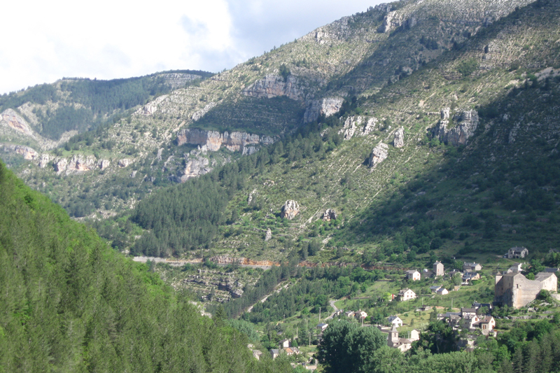
In the morning I walked around town, up and down the steep cobbled streets. The 12th century church was closed, and I was disappointed, having read that it contains old wooden statues and other art said to be quite beautiful. Throughout the medieval village there are excellent informative small plaques explaining its history. Somewhere I remember reading that there was no passable road up this steep and awesome gorge until around 1905. Before that travel was by boat – and so the villages were located right at rivers edge, often well below the cliffs and I imagined that the tourist boat that I saw was derived from a traditional riverboat, one that could probably be poled.I saw one of those old towns later in the morning, on the way up the Tarn.
After my walk, I left town and continued riding up the gorge, following the river, through Quezac and Ispagnac then turned towards Florac on the N106. I know these town names are very old, but nothing of their derivation. The little bit of riding on the much larger N106 road was easy, not intimidating, even with traffic whizzing by, this was probably helped by the large signs warning drivers of cyclists. For a bit on the way to Florac the road surface was rough and gravelly, and made me realize that I had been taking the good, smooth roads for granted. At Florac, where I only stopped to buy a bit more food, I turned back west on the D907 (now north of Mont Aigoual) and headed to the Col du Perjuret (1031 m).
On the way up the long, one-chevron, climb I passed a memorial to Roger le Rivière, one of France’s premier cyclists, a national favorite who crashed here in the 1960 tour de France. The memorial looked as if he died in the crash, and the road certainly dropped off enough for my imagination. (I learned later that he had a terrible accident and never raced again, but was not killed.) It was sobering and put a different historic context on my day’s ride. It is said that you can always pull more strength, more skills, out of somewhere, for the climbs, but I felt like I was probably riding pretty close to the top of my ability – and loving it! The climb went by, long and steep enough for me, with lunch eaten on a rocky outshoot overlooking a river and small, green, hilly fields below. The sides of the road sometimes offered sheer drops, often to the Fraissinet River, the fields terraced far up the hillsides, with vegetables, grape vines, cherry trees.
When I reached the col at 1031 meters, there are again hiking trails crossing through the area, and the D18 cuts off South across the Causse to Mont Aigoual. I didn’t take it, but later wished that I had; again, it’s another trip. In looking at the photo I remember how tired I was; I didn't have the where-with-all to pick up my bike and put it in front of the sign, across the rain gulch; its 70 pounds were more than I could manage.
Next


Bonjour, je suis français, et habite en Cévennes.
ReplyDeleteJe suis le webmaster de http://veloencevennes.free.fr/.
Si d'avanture vos roues vous mènent à nouveau ici, prenez connaissance du site
Sportivement
Merci pour votre remarque, et aussi bien sûr pour le nom de votre site. Je l'ai trouvé malheuresement après mon balade en Cévennes. Mais je le trouve tres bien, utile, avec tellement belles photos et plein d'information. Donc, le nom de votre site est inclu dan la liste de renseignements sur mon site, ici: http://susancycling.blogspot.com/2011/11/france-
Deleteresources-websites.html. Excusez mon francais, avec tous mes fautes!