55 miles Challenging Paved Roads
Start: Lee
Towns: Lee, Tyringham, Monterey, New Marlboro, Otis
 |
| Tyringham Valley |
Today my car needed some work done, so I left it at Chuck Larson's shop, Larson Automotive. If you're visiting for the cyclosportif and for some reason need an auto mechanic, there's my suggestion. He's fabulous. But I digress. I mention that because I rode south from there, using parts of the upcoming cyclosportif route. I'll tell you where I was on, and off, that route. As I understand it, the route includes a few sections of roads that I have never ridden, and I wanted to try them. Today's discoveries were lovely rural roads perfect for cycling.
 |
| Tyringham Cobble |
After leaving busy Route 20 and 102, my route first took me up pretty Tyringham Valley, which both the 100K and 138K will use. Immediately to the south of the village itself is Tyringham Cobble, a Trustees of Reservations property, whose 2-mile hiking trail loops to the summit, with its spectacular views of the valley, then returns to the parking lot. The Trustees are a Massachusetts land conservancy organization, with beautiful sites all across the state. If you're visiting look for their properties. The road surface was good in Tyringham, less so in South Lee.
 |
| Lake Garfield in Monterey |
I decided to follow the 100K route, turning south towards Monterey on Tyringham- Monterey Road, where the 138K continues straight. As best I remember, the road climbs for about 600 feet. I have ridden the other direction too, straight ahead on Tyringham Road. Both routes climb; my sense is that the 138K route is steeper, though I'm not sure. Today I'll return that way. But if you are following the 100K route, when you see the sign "Lake Garfield Watershed," you're at the top.
In Monterey, a pretty village, the route turns right onto Rt. 23 for several miles. There is occasionally a bit of shoulder, not much, on Rt. 23. This can be a busy road, particularly in the summer, when our seasonal residents have returned. Probably in early May it will be fairly quiet. Within less than 3 miles the cyclosportif route turns south onto Corashire Road and so did I.
 |
| Corashire Road |
New to me, Corashire was a pretty, if short, section of the ride. It descends gradually from Route 23 to Route 57, linking these two major east-west thoroughfares. But keep in mind, a major road here might be far quieter than in more developed parts of the US. To those of us accustomed to March in this part of the world something is missing in this photo: maple syrup buckets. The winter has been so abnormally warm that there has been essentially no syrup season.
 |
| Intersection of County and GB-Mill River Road |
A couple quick turns brought me to Great Barrington-Mill River Road. At the intersection with County Road I left the cyclosportif route (or at least my understanding of it.) I believe the route, which both the shorter and longer versions will ride, follows County Road, either going straight, or bearing right, depending on how you think about it. But I wanted to continue south to Mill River, so I took the left fork. From Mill River I continued to Southfield, where I turned back north to Rt.57 east, which I rode last week (for details in the proper direction see the post
Route 57.) This put me back on the 138K route, although riding in the opposite direction. See Route 57 post for a description of the ride in the proper direction.
 |
| Farmington River next to Route 8 |
After crossing Rt. 57 from west to east, with (in this direction) a delightful long descent, I turned north on Rt. 8 to Cold Spring Rd. The 138K ride will use this road but travelling south on Rt. 8. The road follows the Farmington River, but riding it today was a drag, because the road was milled in preparation for resurfacing. However, the new surface should make a good ride in May, and the ride in that direction is a long gentle downhill.
 |
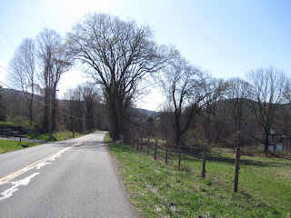
| Fence |
I turned left onto Cold Spring Road, which I've never ridden before. It was pretty, very rural, with virtually no traffic. Next to the road was the oddest fence I've ever seen, made of sections that looked like mattress innersprings, but shorter. The fence was long, looked old, and I wondered about its history.
 |
| Beaver lodge. |
The road is flat on the top, higher than both Rt. 8 and Rt. 23, which it links, and passes through extensive swampland, created by the beaver population. For the first time ever, I saw one sunning itself, I guess, on top of a smallish lodge. If you look very carefully you'll see it. Today there were a pair of common mergansers swimming nearby on the beaver pond. This is also good moose habitat, I see them from time to time.
Before descending to Rt. 23, I passed Lower Spectacle Pond, a lovely small lake that Mass Audubon was key to protecting. The acres protected around the pond contain rare old growth forest, particularly hemlock, some of which is said to predate European settlers arrival.
 |
| Lower Spectacle Pond |
Descending to Rt. 23, I turned left, then immediately right onto Tyringham-Monterey Road, still following the 138K route backwards. Throughout the Berkshires, and on today's ride, road surface quality varies greatly from town to town. When you see a sign marking town boundaries, watch for changes in the road surfaces. This part of the route has a great hill, which today I was riding down, and the road surface was smooth and fast. It was fun, partly because I more frequently ride up this hill. I continued straight back down the Tyringham valley, retracing my pedals.
 |
| Cold Spring Road |
My brand new bike computer records altitude and temperature, as well as cadence, distance, etc. It confirmed that it was cold, which my numb fingers had told me, particularly at the start of the day...30F. We have had a stretch of very warm weather, and somehow I no longer expect it to be cold, though it usually is this time of year. By May, it should be considerably warmer, with trees and bushes in bloom. I finished the ride back at Larson's, with an even 55 miles and 4283 feet of climbing. All in all, this is a good addition to my collection of Berkshires cycling routes.
Other Berkshire Classic Cyclosportif posts include:
Back to
Berkshire County Rides list


What a fantastic ride! Beautiful photos. I was especially fascinated to see the maple trees and the beaver lodge. We get beaver relatives - ragondins, which I think are nutria in the states - but don't do any tree felling or damming. Just lots of bank damage.
ReplyDeleteThanks Steph ... Maybe we could start two-way traffic, and you could "hop" over, so we could go for a ride! This is also good cycling territory, and I try to continually remind myself of that.
DeleteI was once eating dinner at a bistro in Languedoc next to a canal, where ducks were running around begging and amusing everyone. They forfeited all attention when a ragodin appeared to beg. He was so well known that he had a name! Bigger, I think, than nutria and way smaller (at least this guy) than beavers.